Closing the Unsheltered Data Gap
Communities Can’t Fix What They Can’t See
Sheltered clients are recorded in HMIS. Unsheltered PIT data lives in notes, spreadsheets, and one-off apps, creating scattered information, incomplete visibility, and fragile coordination.
Outreach teams know the drill: days spent building trust in the field, followed by nights trying to turn notes into something that counts. Data slips between people, programs, and platforms, and the picture never quite adds up.
Once a year, the PIT count makes that gap visible. For the rest of the year, it stays open — unseen, unmeasured, and unresolved. The issue isn’t effort. It’s the lack of connection between what’s gathered in the field and what lives in the system.
Real Progress Happens Between Counts
For many communities, progress still means passing the PIT compliance test once a year. The box gets checked, but the data collected for that moment rarely connects to the daily work of finding, engaging, and housing people.
That’s the limitation of snapshots — they freeze a moment but miss the movement. When unsheltered PIT data connects directly to HMIS, communities gain continuous visibility into what’s changing, where needs are shifting, and how progress is taking shape.
With sheltered and unsheltered data finally working together, the picture becomes whole. That connection strengthens planning, coordination, and outreach, turning fragmented efforts into a unified response. Frontline teams see progress in motion, leaders see numbers they can trust, and communities move from reporting homelessness to managing the response.

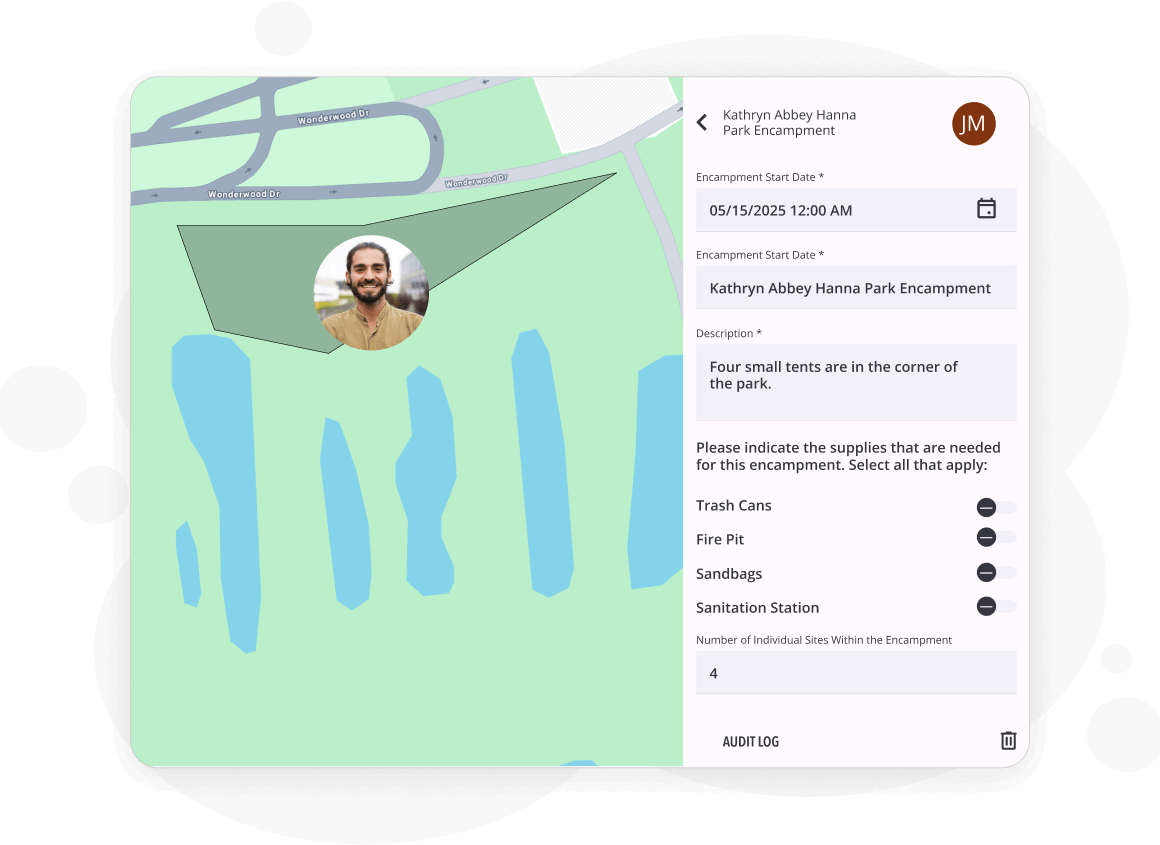
Every contact and location captured in the field, not transcribed later.

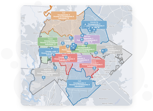
ArcGIS mapping to spot encampments, plan routes, and track change over time.

Clarity Human Services linking every record, program, and partner in one coordinated system.
"GIS location data in our HMIS has allowed us to turn data into targeted action. This technology empowers our community to respond smarter, reach further and ensure that our neighbors are not only seen but supported and connected to any resource we have available in the community."

Shamika Murray Agbeviade
Management Analyst, Homeless Management Information System, Mecklenburg County
"Since we switched our technology software, outreach teams have been able to collect real-time data while out in the community, which gives the community a more accurate picture of unsheltered homelessness in our County."

Jessica Lefkowitz
Executive Director - Hearts For The Invisible Charlotte Coalition
Board Chair - Mecklenburg County Continuum of Care
One System That Sees the Whole Picture
Communities need a complete view of homelessness that connects both sheltered and unsheltered data in real time. Clarity Human Services makes that possible by linking field insights, housing information, and location data in one coordinated system.
With the new ArcGIS Survey123 integration, communities can import unsheltered PIT surveys into Clarity, review and map the survey data within the system, and generate a complete HUD PIT report in a single step.
The result is one shared source of truth that connects every person, place, and program involved in homelessness response.
Credible Data Builds Confident Systems
Connecting unsheltered and sheltered data in one system gives communities the reliability they need to act with confidence. Visibility isn’t only operational — it’s reputational and financial. It helps teams track real progress, gives leaders confidence in their numbers, and shows funders results they can trust.
Credibility connects daily coordination to long-term stability. It turns data from a record of activity into a shared understanding of what’s working and why. Communities that lead with continuous, connected data earn leverage in funding conversations and build confidence that grows over time.
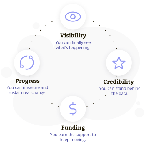
Visibility creates credibility. Credibility attracts funding. Funding sustains progress.