When it comes to providing care for homeless populations, there’s a misconception that those who are in need of help will actively seek it. This is not always the case.
There are many factors that might deter someone from seeking assistance. They could have health challenges, or hesitate based on bad experiences with past services. They might fear being separated from a pet or child. Regardless of the circumstances, establishing trust between systems of care and homeless individuals is paramount to providing meaningful aid.
That’s where homeless outreach services come in.
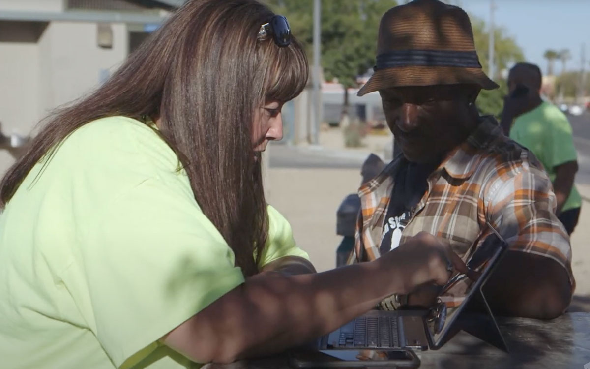
Outreach involves going into the field to bring services directly to homeless populations rather than relying on them coming to you. In doing so, service workers build relationships in a non-transactional way. You can provide fresh pairs of socks, bottles of water, bus tickets, sunscreen, blankets, or other essentials in hopes of encouraging individuals to accept additional services at their own pace.
What used to be a manual process is now increasingly enhanced by technology. Therefore, it's more important for your clients' safety than ever to make engagement as streamlined and non-intrusive as possible. Using an HMIS with built-in coordinated entry, you can head into the field with tools at your disposal to build out HMIS client profiles over time, assess needs, directly enroll clients into services, and prioritize the most vulnerable individuals while still supplying the same immediate assistance and protecting their privacy.
In the process, you cultivate more accurate data, track trends, and measure success from housing all the way back to your first outreach efforts. Now, a crucial element has been added: geospatial analytics.
The Importance of Outreach
Outreach has long been a core element of communities’ efforts to combat homelessness. But in the last few years, due to the outbreak of the novel coronavirus (COVID-19), it grew in importance with geospatial analytics playing a key role.
COVID-19 posed an especially serious threat to already vulnerable homeless populations. Many individuals were living in close quarters in encampments. Others carried underlying health issues, leaving them at high risk for severe infections.
Communities have relied on location data to develop strategies to combat the spread. They identify trends, track encampments, and establish strategies to bring services to clients efficiently and safely. Furthermore, they were able to implement contact-tracing, a key factor in measuring the virus’s impact.
Beyond COVID-19, geospatial analytics supports case workers’ whole person care efforts. They can track trends and communicate across systems of care to assist clients.
Geospatial functionality has improved the engagement experience for both front-line workers and clients, and empowered policymakers with a better understanding of what is occurring in the community and where.
Streamlining Outreach Efforts
The benefits of geospatial analytics were always evident. Continuums of Care (CoCs) were challenged to create more effective ways to track and analyze data to better allocate resources and identify the most vulnerable populations. COVID-19 has only amplified those challenges, not revealed them. Communities raced to secure federal funding and provide housing solutions to prevent the further spread of the virus.
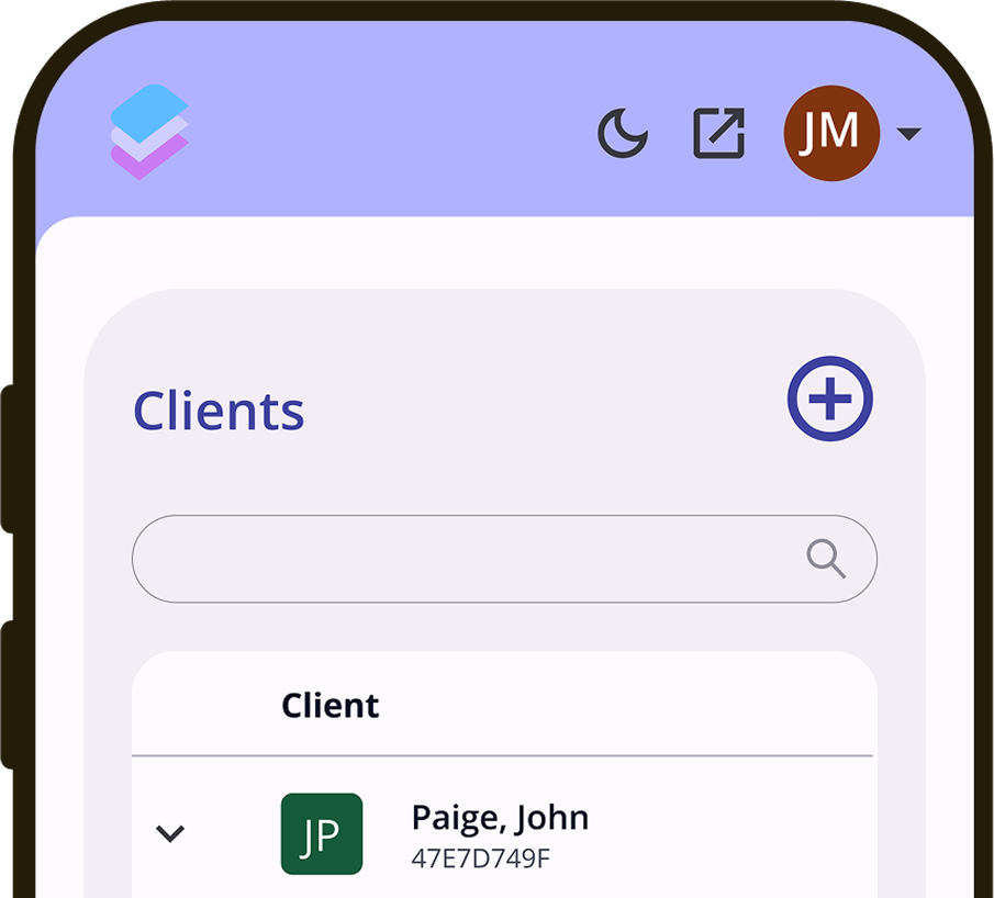
Responding to this critical situation, Bitfocus worked to fast-track functionality that would streamline communities’ outreach and engagement. The result is an innovative addition to Clarity Human Services, appropriately called ‘Outreach.’
The functionality allows you to track encampments as well as individuals who live outside of a camp. Authorized users can draw encampments on an interactive map powered by ArcGIS, name them, add a description, mark them as active/inactive, and view an audit log of any changes that have been made. There is also a time-scrubbing option, so you can track how the data has shifted over time.
This information enables you to build context. Consider the importance of geospatial data to creating custom assessments as the VI-SPDAT is phased out. You can better understand trends and behaviors to properly gauge the needs of your community.
Crucially, you can make real-time decisions while getting a better idea of the overall picture.
For all its technological advantages, such improvements to engagement set the path to stability for homeless individuals. Front-line workers have better tools in hand to provide the right assistance at the right time, and clients receive the most relevant care they can get.
For more information on Outreach, visit bitfocus.com/outreach.